

Map courtesy of trailcentral.com
http://www.trailcentral.com/
This one relatively small area has a whole boatload of names. The route I usually take starts from the north parking lot, I'll hit Dakota Ridge first, taking that all the way south, then take red rocks trail all the way up to the northern terminus of the Morrison Slide trailhead, loop south on that, then redo Red Rocks and take that all the way back to the lot. I don't do this to get in extra miles, I do this because I'm a big wussy and I think that the climb from the southern road crossing up to the first junction with Morrison Slide is one of the most demoralizing slogs on the front range, so by the time I get there I don't have the heart to grunt up the M.S. switchbacks.
What follows is a mixture of photos, some taken Fall of '03 with the small camera, others taken later, with better equuipment, and better skills.

This picture was taken near the top of the climb up Morrison Slide, looking north. The trail that heads up to the horizon is the climb up to Dakota Ridge, it never feels like the right way to start a ride.

This is the first part of Dakota Ridge trail. A relatively smooth area. This section is the calm before the storm

Some technical tastiness, and some views.

More smooth stuff.

Then some rocks.

And a series of steep little ramps, spaced about one bike length apart.


(Yes, that is a freakishly steep drop right at the trail's edge)


(hey, look, it's me! How'd that happen?)

This is the descent to the southern terminus of Dakota Ridge.

And here's the last pitch of the climb up to the flat part of Red Rocks Trail. The next few shots show the climb up the northern side of Morrison Slide.


And this is the top of Morrison Slide.


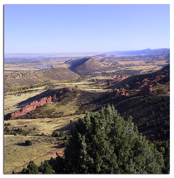
A view south from the top of the Morrison Slide climb, giving a nice overview of the intracacies of the Dakota Hogback and Red Rocks formations.
Here's a somewhat clear description of the geological processes that created all of this.


